
Worksheets and No Prep Teaching Resources
Reading Comprehension Worksheets
Geography

Geography
|
Worksheets and No Prep Teaching Resources Reading Comprehension Worksheets Geography |
Geography |
| edHelper's suggested reading level: | grades 5 to 7 | |
| Flesch-Kincaid grade level: | 6.07 |
|
Earth's Grid System
By Trista L. Pollard |
|
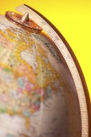 1 Long before astronauts traveled into space, people had to guess about Earth's shape. Some thought it was flat. Others thought it was a disc. However, no one had real proof about its shape. That is until ancient Greek geographers came along. They were some of the first scientists to figure out the shape of our planet. These geographers used mathematics and their observations to design the first globes. These globes were our first models of Earth.
 |
Create Weekly Reading Books
Prepare for an entire week at once! |
| Leave your feedback on Earth's Grid System (use this link if you found an error in the story) |
|
Geography
|