Fourth Grade
Worksheets
World on a Window Sill, Part 1
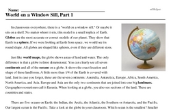
In classrooms everywhere, there is a "world on a window sill." Or maybe it sits on a shelf. No matter where it sits, this model is a small replica of Earth. Globes are the most accurate or correct models of our planet. They show that Earth is a sphere. If we were looking at Earth from space, we would see its round shape. All globes are shaped like spheres, even if they are different sizes.
Just like world maps, the globe shows areas of land and water. The only difference is that a globe is three dimensional. You can clearly see all seven continents and all of the oceans on a globe. It shows the exact location and shape of these landforms. A little more than 1/4 of the Earth is covered with land. Just in case you forgot, these are the seven continents: Australia, Antarctica, Europe, Africa, South America, North America, and Asia. Europe and Asia are the only two continents that are joined into one big landmass. Geographers sometimes call it Eurasia. When looking at a globe, you also see sections of the land. These are countries and states.
There are five oceans on Earth: the Indian, the Arctic, the Atlantic, the Southern or Antarctic, and the Pacific. Our largest ocean is the Pacific. Take a look at the globe in your classroom. Which ocean is the smallest? Smaller bodies of water flow into our oceans. You will learn about those landforms later.